The Project
Trilogy was engaged to undertake a geotechnical feasibility study for a proposed containment cell at a former industrial site on the South Australian coast. The cell is intended to provide permanent on-site retention of contaminated materials as part of the broader remediation and redevelopment of the site, with the cliff top area to be transferred to the state government as public open space.
The proposed location sits at the edge of a coastal cliff top complex, bordered by steep slopes to the west and south. Two fundamental questions had to be answered before feasibility could be confirmed — and both carried significant cost and programme implications.
1. Can you excavate and load a containment cell on a coastal cliff top without destabilising the adjacent slopes? 2. Can the site's natural clays be used as the liner material — avoiding the cost of importing an engineered liner product?
Investigation
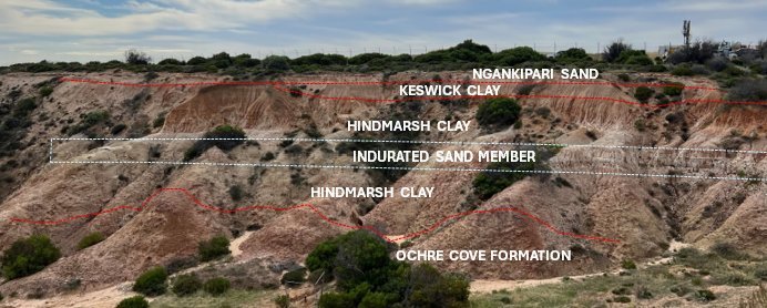
Cliff face geological mapping. Rather than relying solely on boreholes, Trilogy undertook a dedicated geological mapping exercise on the cliff face directly below the proposed cell — identifying the Ochre Cove Formation at the base, overlain by the Hindmarsh Clay sequence with interbedded sandy horizons, transitioning to Keswick Clay and a veneer of Ngankipari Sand at the surface. This direct outcrop observation confirmed the stratigraphic sequence, revealed collapsing sand behaviour in the Ngankipari Sand, and confirmed that observed instability was confined to the southern cliff system rather than approaching the proposed cell location.
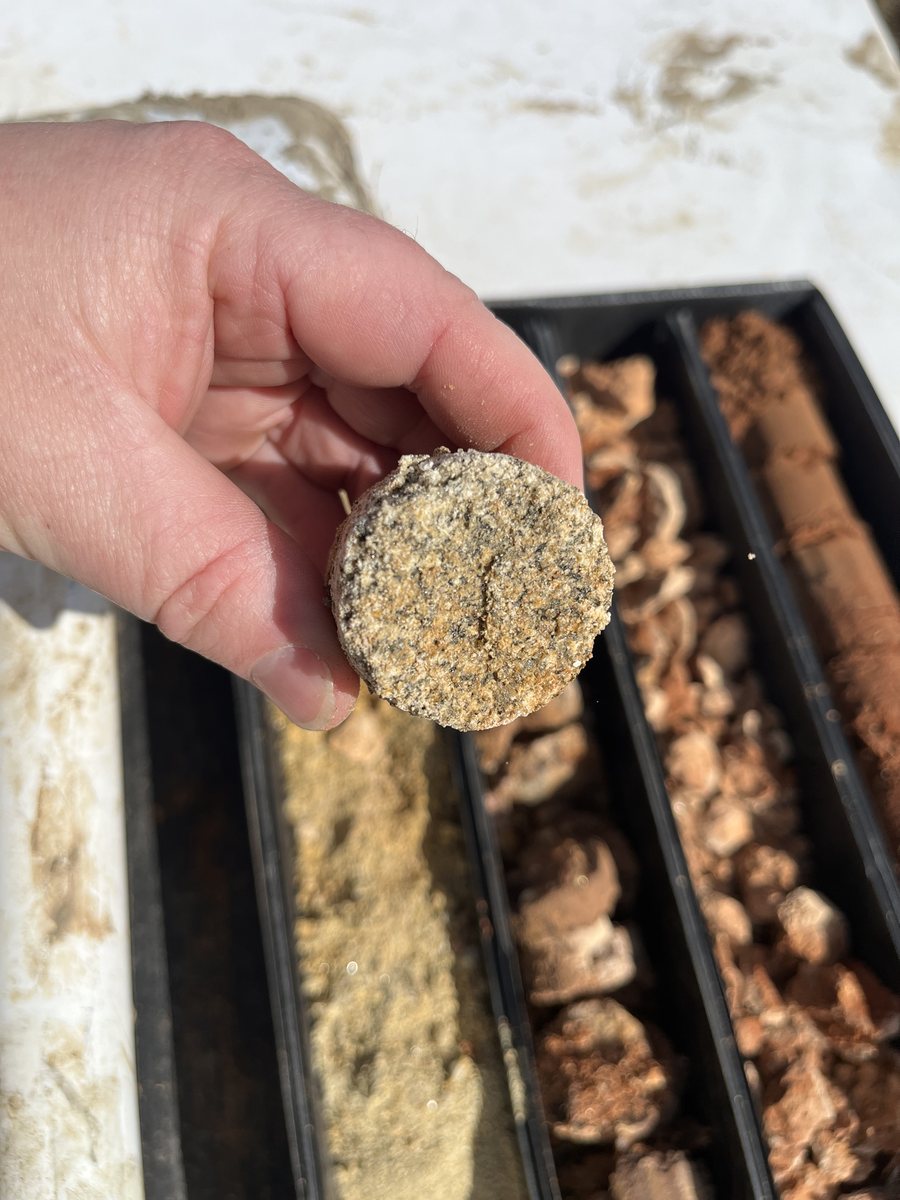
Five boreholes to 15 m BGL using rotary coring and augering, with SPT at selected intervals and undisturbed samples for strength and permeability testing. The investigation confirmed the stratified sequence and encountered a circular steel sheet at ~2.5 m depth in one borehole requiring coring through — evidence of prior buried infrastructure within the investigation area.
Liner Suitability Testing
A targeted laboratory program — going well beyond standard geotechnical testing — assessed whether natural site clays could serve as the containment cell liner:
- Atterberg limits and linear shrinkage (9 samples): confirming plasticity and clay content
- PSD with hydrometer: confirming clay fraction ≥0.002 mm
- Falling head permeability: Hindmarsh Clay result at the threshold typically specified for compacted clay liners — requiring careful compaction control to reliably achieve the target in the field
- Emerson Class testing (5 samples): Class 2 results indicating dispersive behaviour requiring erosion control management
- Calcium carbonate content: to contextualise Emerson results where carbonate may mask dispersivity
- Organic content and soaked CBR: liner compatibility and trafficability
Slope Stability — 8 Scenarios
Three critical cross-sections extracted from the updated Leapfrog 3D model were used in GeoStudio SLOPE/W limit equilibrium analyses (Morgenstern-Price method). Eight load scenarios were assessed, from current geometry through to the filled containment cell under saturated worst-case and pseudo-static earthquake conditions:
- LS1: Current slope geometry
- LS2: Current geometry, elevated groundwater (saturated worst case)
- LS3: Excavated cell (1H:3V batters)
- LS4: Excavated cell, saturated worst case
- LS5: Filled cell with clean cap
- LS6: Filled cell with clean cap, saturated worst case
- LS7: Pseudo-static earthquake case

Outcomes
- Slope stability confirmed across all scenarios — providing the feasibility case for the preferred excavation geometry and batter design
- Liner suitability of Hindmarsh Clay confirmed in principle — with explicit identification that compaction control is critical given the permeability result at the specified threshold
- Dispersive clay behaviour flagged — requiring specific erosion management during liner installation
- Cliff face mapping confirmed instability confined to southern cliff system — removing a key risk from the feasibility assessment
- Full feasibility picture delivered: investigation, 3D modelling, stability analysis, and liner assessment integrated into a single scope