The Project
Trilogy was commissioned to undertake a geotechnical settlement assessment at a brownfield redevelopment site in inner-suburban Adelaide. The specific scope was narrow but technically demanding: assess the settlement risk to proposed road pavements and a gravity-fed stormwater system, both of which crossed directly over mapped pughole extents containing coal tar-saturated fill up to approximately 10 m deep.
Gravity stormwater infrastructure cannot tolerate the same settlement as a road. Both alignments crossed a 10-metre deep former industrial-era pughole whose fill was partially saturated with free-phase coal tar — a material that does not consolidate in the conventional sense, ruling out the most cost-effective mitigation option before analysis had even begun.
Investigation
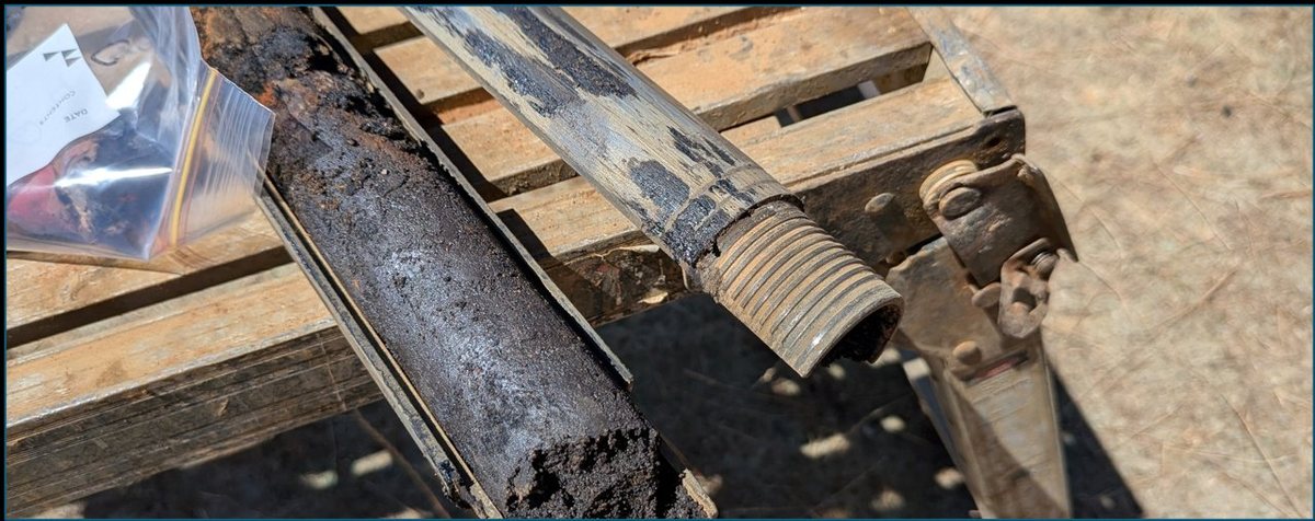
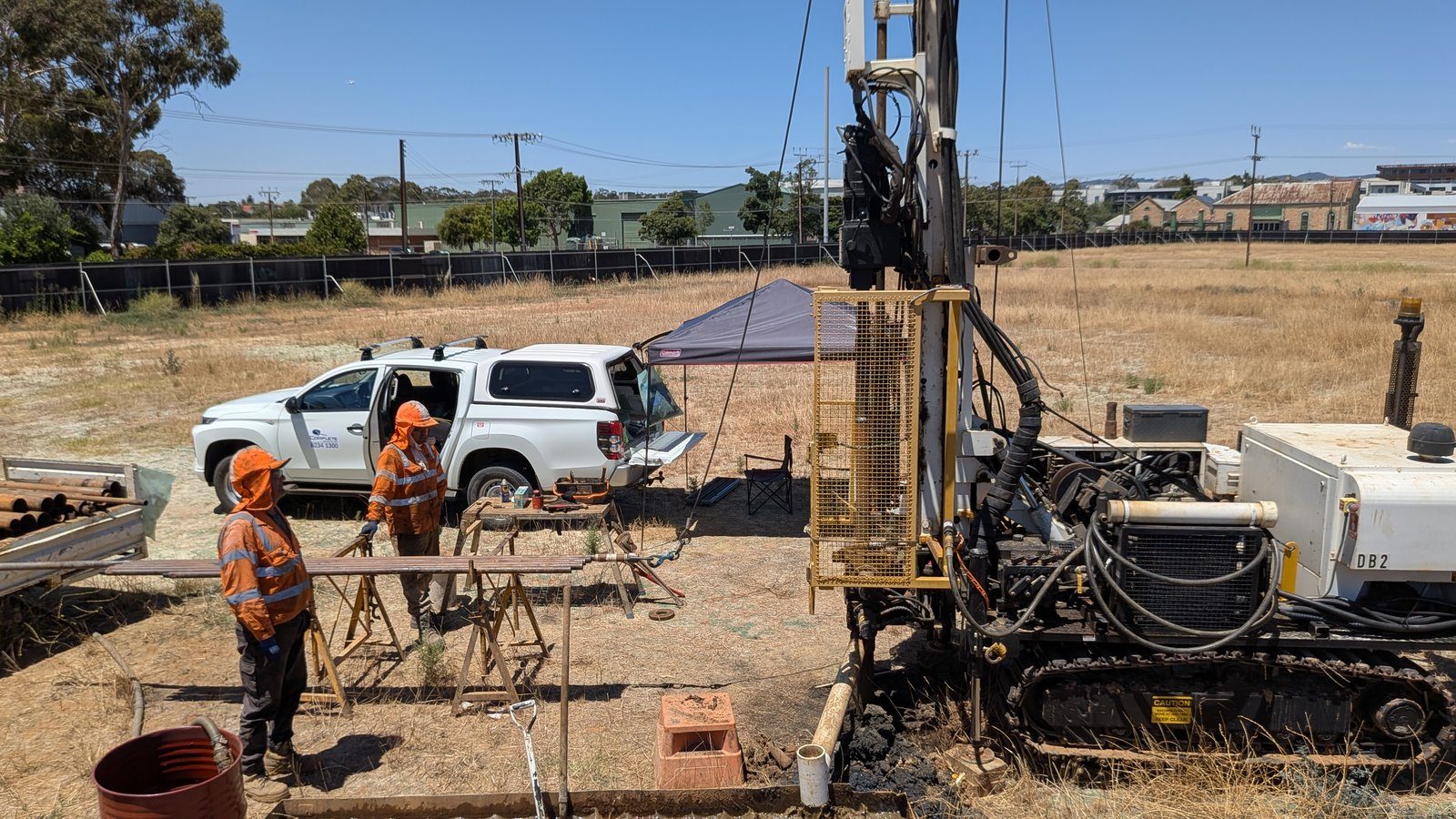
Three boreholes were drilled to 25 m BGL using rotary, rock roller, and diamond coring — penetrating the full pughole sequence and into the underlying Hindmarsh Clay. Four CPT soundings across the pughole extents provided continuous high-resolution stiffness profiling. Environmental borehole records from prior Trilogy site investigations were integrated into the ground model, extending coverage of pughole depth and lateral extent without additional fieldwork.
The subsurface model was constructed in Leapfrog, then imported into PLAXIS 3D via the Central hosting platform — representing road pavement, stormwater trench geometry, and backfill sequence in three dimensions so that trench-to-pughole interaction effects could be captured explicitly.

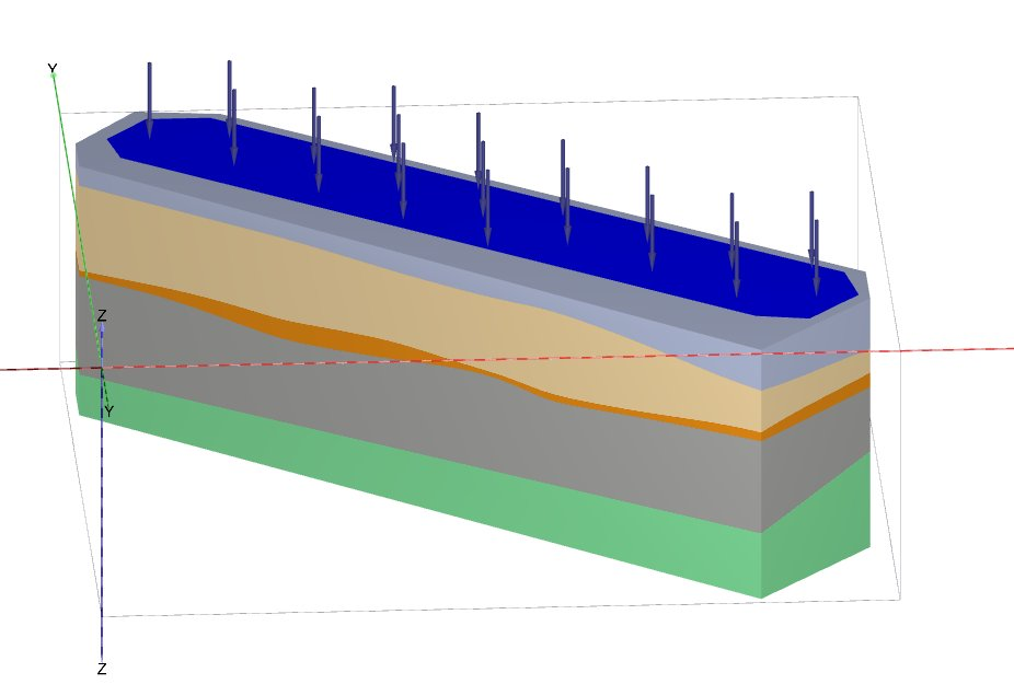
Five FEM Sensitivity Cases
- Case 1 (base): representative parameters for granular pughole fill (E₅₀,ref = 5 MPa) — max settlement 32 mm, differential 31 mm
- Case 2 (0.50 reduction factor): max 45 mm, differential 44 mm
- Case 3 (0.33 reduction factor): max 60 mm, differential 59 mm
- Case 4 (0.33 reduction, 40-year consolidation): long-term additional settlement 0.05 mm — confirming coal tar fill does not consolidate
- Case 5 (0.33 reduction, 40 kPa construction load, 10-year duration): max 131 mm, differential 121 mm — the governing case
Why Surcharging Was Ruled Out
Evidence from prior investigations at the site confirmed that coal tar-impacted soils had not consolidated under pseudo-preloading conditions — rebounding elastically rather than undergoing permanent volumetric change. Sensitivity Case 4 confirmed this: long-term consolidation over 40 years added just 0.05 mm. Surcharging — typically the most cost-effective mitigation for soft or compressible fill — was definitively closed off as an option.
Five-Option MCA
With settlement quantified and surcharging eliminated, Trilogy assessed five mitigation options through a Multi-Criteria Assessment covering cost, effectiveness, timeframe, installation complexity, maintenance burden, and residual risk:
- Pile and beam system (~$0.5–1.0M): highest cost, highest certainty — bypasses pughole entirely
- Controlled modulus columns (CMCs): preferred option — cost-effective rigid inclusion ground improvement, compatible with the constrained site conditions
- Deep dynamic compaction: limited effectiveness in coal tar-saturated materials
- Surcharge preloading: ruled out on technical grounds (coal tar behaviour)
- Accept and monitor: not appropriate for gravity stormwater infrastructure
Outcomes
- Settlement quantified to ±30 mm precision across five scenarios — converting qualitative risk into actionable design numbers
- Coal tar behaviour analytically confirmed — surcharging definitively ruled out, saving the client pursuing an ineffective mitigation path
- CMCs identified as the preferred solution through a structured MCA — a cost-effective rigid inclusion method compatible with the site constraints
- Governing case (131 mm under construction loading) identified — providing the structural engineer with the design envelope for trench and junction details
- Concentrated settlement troughs at trench intersections identified as the governing serviceability mechanism — not generalised pavement settlement